
Transylvania
Transfăgărășan Highway: Route, Stops and Current Access Checks
The short answer
Choose the road for a scenic day with a flexible route. Read dated road-administrator and police notices for the section you intend to use. If the high crossing is closed, take another intercity route and consider a lower approach as a separate outing.
What's covered9
By Unseen Romania · Updated
The Transfagarasan Highway needs a current road-status check before it becomes a through-route in your plan. Plan the approach, legal stops and a turn-back option. Do not assume the high section is open because a travel article calls a month the driving season.
Decide whether the drive fits your route
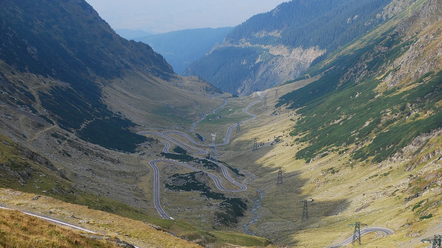
The DN7C mountain crossing is a winding scenic drive. Allow time for stops and weather rather than treating it as a quick transfer between two towns.
Decide between a through-drive and an outing from one side. A closed high section can prevent the crossing while leaving lower approaches open. Read the affected stretch in the official notice.
For a fixed arrival or flight, use a route with enough margin for delays. Give the scenic drive a separate day if turning back would otherwise disrupt onward travel.
The Transylvania guide helps place the drive in a wider route. Do not add it between distant bases merely to collect a well-known road name.
Check the dated official road status
Use CNAIR and Romanian Police traffic details for the date and exact DN7C section. Read the notice's time, limits, direction and any conditions. Avoid inferring access from a search headline.
Snow, maintenance and limits can change the usable road. A statement about a previous year or an earlier part of the season does not prove through-access today.
Before departure, establish which section is open and where you can legally turn back. Without current confirmation of the crossing, use an alternative intercity route. Another vehicle heading uphill does not establish through-access.
Read updates if conditions change. An open road does not establish that nearby mountain trails are suitable for walking.
Real road map, approaches and turn-back points
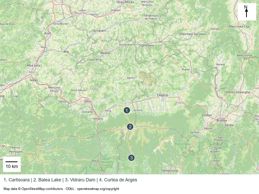
The orientation points are Cârțișoara on the northern approach, Bâlea Lake near the high section, Vidraru Dam farther south and Curtea de Argeș beyond it. The map shows their relationship, not a current-open-status layer or a timed driving route.
Choose the approach and a point beyond which you will not continue without confirmed access. Turn only where it is legal and safe, rather than where the route on a phone happens to end.
Save an alternative intercity route before setting off. Decide whether a closure leaves time for a shorter scenic outing or requires abandoning the mountain approach. Keep onward bookings independent of an unconfirmed crossing.
Use the administrator's exact kilometre limits when reading a notice. A statement affecting one section should not be expanded into a claim that each lower approach is closed, or shrunk into a claim that the high crossing is still possible.
Road stops and parking constraints
1. Cârțișoara approach
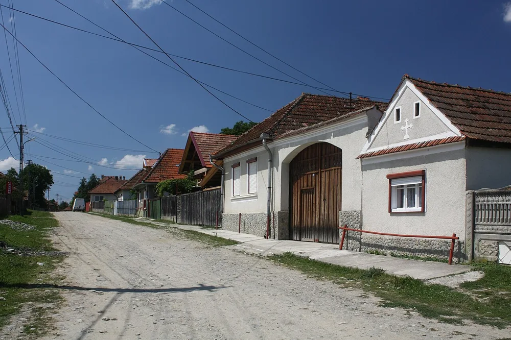
Use the northern approach to settle the road-status and onward plan before committing to the high section. Check where you can legally stop and turn around. A village road or private entrance is not a default lay-by.
2. Bâlea area
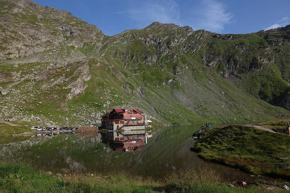


Include Bâlea only when the approach is open for your date. Use legal parking on arrival; a road photograph does not establish a safe stopping place.
For a walk beyond the road, plan the trail separately using Salvamont advice and the forecast. A short-looking mountain path can require more preparation than a roadside stop.
3. Vidraru Dam area
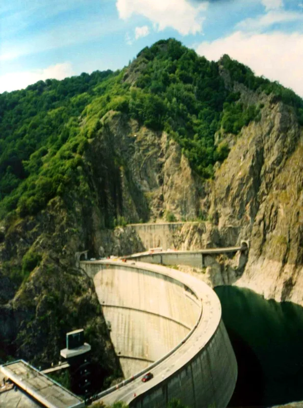

Distinguish the dam stop from the high crossing. Check the road and legal stopping details for the exact visit. Do not assume that seeing one southern landmark proves the northern mountain section is open.
4. Curtea de Argeș
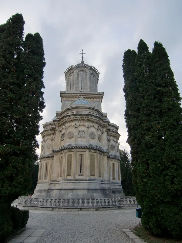

Use Curtea de Argeș as a route stop or overnight base without rushing the mountain section to reach it. Keep an alternative approach if the high crossing is closed.
Fuel, time allowances and weather alternatives
Plan fuel before the mountain section. Avoid assuming there will be a suitable stop exactly when you want one. Check the car's needs and the exact services on your chosen route. A generic map symbol is not proof that a business is open at your arrival time.
Keep enough daylight for the road and any stops you intend to make. The aim is not to complete an arbitrary photo list. If a stop would require unsafe parking or a rushed return, leave it out.
Use ANM for forecasts and warnings. Conditions at a base town do not establish the weather on the high road. Fog, rain or other poor conditions can change both the view and the driving decision.
For poor weather, choose a town or lower-level visit on your side of the mountains. On a northern approach, compare Sibiu or the ASTRA museum with their own opening arrangements. Driving farther uphill may not improve the view.
Wildlife, driving and seasonal cautions
Follow official road rules and any on-site limits. Do not stop in the running lane to take a photo or approach wildlife. A scenic route remains a working road, with other drivers and conditions that may change around bends.
For wildlife encounters, follow the responsible authorities' instructions. Keep distance and do not feed animals. Do not choose a stopping place because an animal is beside the road. A popular photo is not evidence that the behaviour used to obtain it is appropriate.
Choose a drive that suits the least confident driver and passenger. Take breaks where stopping is legal. If weather or road conditions become unsuitable, use the alternative rather than forcing completion.
For a rental car, read the agreement's road restrictions. Booking a vehicle does not authorise driving through a closure or on an excluded road.
Verdict
Choose the Transfagarasan Highway as a flexible scenic day with confirmed access and legal stops. Keep a turnaround and alternative route ready. Adapt to the road and weather rather than forcing a crossing planned from an old travel account.
Frequently asked questions
Is there a fixed opening date every year?
Do not use one as a promise. Check the road administrator's dated notice and the exact affected section before travelling. Seasonal travel summaries and previous-year dates do not check current access. If a through-crossing cannot be confirmed, choose another intercity route and keep the scenic outing conditional.
Does an open road mean nearby hiking is suitable?
No. Trails have their own access restrictions and terrain. Consult Salvamont and the forecast for the exact walk. Reaching a car park does not establish that a nearby mountain path suits the group or the return conditions.
Can I stop wherever the view is good?
Use legal, suitable stopping places and follow current limits. A road bend, running lane or wildlife gathering is not a photo lay-by. If the desired view cannot be reached without unsafe or prohibited stopping, leave it out. The road remains in use by other vehicles throughout your visit.
What if the high section is closed?
Read the affected section and decide whether a lower approach still suits the day. Use the alternative route for onward travel. A closure of the high section does not necessarily close the entire road, but it can prevent a through-drive.