
Transylvania
Hiking the Carpathian Mountains: Romanian Route Choices and Preparation
We may earn a commission from some links on this page.
The short answer
Start with a small route shortlist near your base. Check the trailhead, authorised route, current conditions and return. If those details are not clear, choose a more manageable outing. Avoid turning a scenic name into an improvised mountain plan.
What's covered9
- Choose a Romanian mountain area and difficulty
- Compare mountain areas and walking options
- Actual trailhead, distance basis and transport chain
- Weather, closures, wildlife and rescue guidance
- Equipment and preparation for the selected route
- Guided outing versus independent walk
- Verdict
- Frequently asked questions
- Related guides
By Unseen Romania · Updated
For hiking Carpathian Mountains routes in Romania, choose the trail and return before judging a walk by its photograph. A gorge walk, forest ascent and exposed ridge demand different skills. Use park and Salvamont guidance to match the route to the whole group.
Choose a Romanian mountain area and difficulty
This guide focuses on choices that can fit a southeastern Transylvania route, in particular Piatra Craiului and the Bucegi area. It does not try to cover the entire Carpathian range or present one universal difficulty scale for each route.
Choose a base near the trailhead. Brașov supports outings around Zărnești and Piatra Craiului; Sinaia is an approach to the Bucegi. Neither town provides easy access to every route described as a Carpathian hike.
Begin with the least experienced member of the party. Consider fitness, experience on uneven ground, exposure, navigation and willingness to turn back. A route that is short on a map can still involve terrain that does not suit the group.
Use Salvamont Romania as the national mountain-rescue reference and the Piatra Craiului or Bucegi administration for the relevant park. A general travel description is not a current route bulletin.
Compare mountain areas and walking options
| Route choice to investigate | Area and starting context | What makes the choice different | Confirm before choosing |
|---|---|---|---|
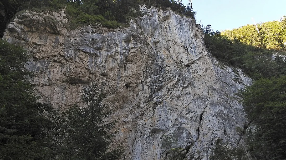
| Prăpăstiile Zărneștilor approach | Zărnești and the gorge approach | A lower-level gorge setting rather than a ridge objective | Current access, the exact start and your turnaround |
| A route towards Cabana Curmătura | Piatra Craiului approaches | Adds a mountain ascent beyond a simple gorge visit | Authorised trail, conditions and the full return |
| A managed thematic route | Bucegi park's published route system | A defined interpretation-led outing | Exact route, access and the transport chain |
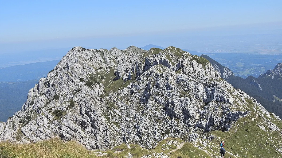
| An exposed high route | Piatra Craiului or Bucegi | A separate mountain objective with greater demands | Current local advice, skills and suitable conditions |
Scroll for more →
The park's listed material identifies the Zărnești, gorge and Curmătura geography. Its tourist-route page is the starting point for official route details. Do not transfer a cycling route's grading or timing to a walking plan.
The Bucegi administration links to thematic routes and a map. Choose a specific marked route. A thematic trail may suit a nature walk better than a summit objective.
Actual trailhead, distance basis and transport chain
Locate the actual trailhead, which may be beyond the town and park entrance. Arrange transport there and back, including a different pickup point if the walk does not return to its start.
For a Zărnești-area plan, distinguish arrival in town from the approach towards the gorge or chosen path. The park's material describes the local approach through the Gura Râului and Botorog area. Use the current map and access details before choosing where to park or arrange pickup.
For Sinaia and the Bucegi, separate lift access from the walk beyond it. A cable car changes the starting altitude, not the demands of the terrain. Establish the return service and the plan if weather stops it.
Read the distance basis carefully. An online figure may cover only the ascent, one section or a route beginning beyond your vehicle drop-off. Add the exact approach and return before judging whether the day fits. Do not convert an unchecked travel-blog estimate into an official route time.
If using a taxi or transfer, agree the return and a good pickup point. A successful outward ride does not prove phone coverage, a waiting driver or an on-demand car at the end of a remote walk.
With a car, check legal parking and any park entry needs. Do not assume an open track is a public driving route. The place where a navigation app stops may be unsuitable for leaving a vehicle or may not be the authorised walking start.
Weather, closures, wildlife and rescue guidance
Check ANM and the relevant local mountain advice before departure. Weather at the room or in a valley town does not establish conditions along the whole route.
Read closure and restriction notices from the park or local Salvamont service. Snow, ice and poor visibility can change a route's demands even when the path appears on the summer map.
Set a turnaround decision before the walk. Link it to daylight, the return chain and the exact conditions. Avoid a desire to reach a named hut or summit at any cost. Turning back can be the correct completion of the plan.
For wildlife, follow official guidance and keep distance. Do not feed or approach an animal for a photo. A busy tourist route does not prove that wildlife encounters are harmless or that the same response suits each situation.
Keep the emergency plan appropriate to the route. Use the official Salvamont site for rescue contacts and current advice, and know your location. Do not depend on a screenshot of a scenic map as the only way to explain where you are.
Choose the route on verified details and the group's abilities, and change it when conditions no longer fit.
Equipment and preparation for the selected route
Pack for the exact ground and weather. Footwear, layers, water, food, navigation and a way to protect key items should follow the chosen route. A short checklist cannot turn unsuitable kit into a suitable mountain plan.
Check the source of drinking water. Avoid assuming each stream or marked spring is appropriate. Carry what the route and current advice require. A hut or café mentioned in an older account may not be open when you reach it.
Use a map you can access without a live connection and understand how to read it. Save the authorised route, start and return points. A line on a screen is not enough if you cannot recognise whether you have left the intended path.
Tell someone the exact plan and expected return method. Keep the details concrete: route, start, intended end and what you will do if you turn back. A general message that you are going hiking in the Carpathians is too broad to describe the day's route.
Agree on pace and turnaround decisions before starting. Choose for the least experienced member rather than the fastest walker, including when an easy first section leads towards harder ground.
Leave room for the trip back to the base. A late finish can affect a lift, pickup, meal or onward train. The walk is only part of the day's chain, just as reaching the trailhead is only the beginning.
Guided outing versus independent walk
A guide can add route knowledge, context and coordination when the exact programme matches your needs. It does not remove weather, access limits or the need for suitable kit. Compare the exact trail. Avoid buying a broad mountains experience label.
Compare the guide's qualifications, language, group size, route, transport and fitness requirements. Establish a suitable alternative if weather or access changes the proposed walk.
For the Zărnești Gorge and Curmătura route, compare the Piatra Craiului hike from Brașov.
For independent walking, choose a route you can navigate and manage using current information. If the terrain or return remains unclear, choose another walk rather than improvising a summit day.
Compare Brașov and Sinaia as bases. Give a demanding hike its own day rather than adding it after a full outing to Bran or Peleș.
Keep a town visit you would enjoy as a poor-weather alternative. Having another plan makes it easier to turn back when conditions no longer suit the route.
Verdict
For hiking Carpathian Mountains routes, choose a precise, manageable day near the right base. Check the route parameters, weather and return before starting. A lower-level outing with a clear plan is a better fit than an exposed objective chosen only from a photo.
Frequently asked questions
Is every short route easy?
No. Distance alone does not prove terrain, exposure or navigation demands. Read the exact route summary and current conditions, including the approach and return. Match the day to the least experienced member of the party. Avoid treating a small number on a map as a promise of suitability.
Can I use a cycling route's time for a walk?
Do not transfer it directly. A cycling summary can help identify geography. But its grading, pace and access may differ from a walking route. Use the authorised tourist route and its own measurement basis. Check whether the listed figure covers one way, a full loop or only part of the day.
Does taking a cable car make the high route straightforward?
It changes the starting point, not the terrain beyond it. Read trail and weather notices and establish the return service. Choose a lower-level alternative if the high route no longer suits the group or the lift stops operating.
Is a guide a guarantee against problems?
No. A qualified guide can help choose and navigate an appropriate route, but weather, restrictions and terrain still matter. Ask about equipment, fitness requirements and route changes before booking, then bring the equipment agreed for the outing.